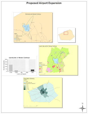
In this lab we had to learn the basics of ArcMap. We learned about displaying map features, adding data to our maps, editing geographic data, working with data tables, selecting specific geographic features, creating graphs, and laying out the final map.
ArcMap is a tremendously complex program with a seemingly steep learning curve. Despite that fact, it's user-interface is surprisingly easy to use and intuitive. I've used Photoshop before, and many of the elements of ArcMap are very similar to Photoshop. This made me feel right at home within ArcMap, and I think made the tutorial a lot easier for me than it would have been for someone who had never used a program like Photoshop.
One feature that kind of trip me up at first, though, was the two different views (data view and layout view) within ArcMap. The whole concept of being able to pan and zoom a data frame within layout view while also being able to pan and zoom the entire layout took a couple minutes for me to wrap my head around. I just had to remember which pan and zoom buttons where which. Once I figure this out, I realized how powerful of a tool ArcMap is in that it can both edit data and layout that data for printing. Another feature that's a little different than photoshop is editing. With ArcMap, you must first turn on editing before your can alter or add data to the map. This provides a layer of protection against accidentally altering something or if you make a mistake while editing.
Another hurdle I had to jump over was actually saving the file. Since I was going between working in the labs and connecting remotely from the dorms, the first time I connected remotely ArcMap didn't find any of the data – instead it just showed red exclamation points. I'm a pretty tech savvy guy, so I figured out that I could show ArcMap where the data was located on my flash drive. I then realized I needed to switch it to relative path names rather than full path names.
This leads me to what I believe is the greatest pitfall of GIS: It's for the tech savvy. As a tech savvy person my self, it's not much of a problem, and this tutorial went very smoothly for me. However, I can see how it could be extremely difficult for someone who doesn't understand how file systems, databases, complex programs, and computers in general work. If something were to go wrong, they might not understand why, so it would be hard for them to avoid in the future. Also, because of the steep learning curve, not anybody could pick up ArcMap and create a map. It's something that really needs to be taught. (This is where neogeography fills the gap of being accessible and easy to use.)
Now, of course, the potential of GIS. In the right (trained) hands, ArcMap has the potential of creating incredibly useful, easy to read, data filled maps. It can be used in many different fields (from public health, resource management, criminology, logistics, marketing, urban planning, etc) to analyze spacial data.
It actually sounds like such a cool field, that now I'm thinking about minoring in GIS.
No comments:
Post a Comment